Island Time
-
Content Count
8,510 -
Joined
-
Last visited
-
Days Won
245
Content Type
Profiles
Media Demo
Forums
Gallery
Calendar
Store
Everything posted by Island Time
-
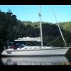
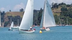
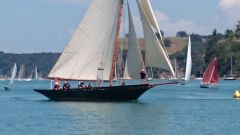
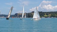
From the album: Mahurangi Regatta 2015
-
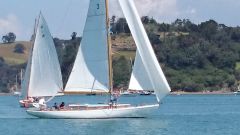
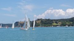
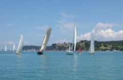
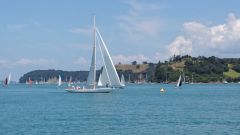
From the album: Mahurangi Regatta 2015
-
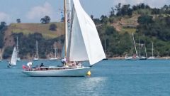
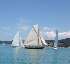
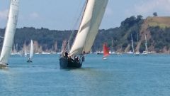
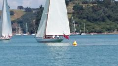
From the album: Mahurangi Regatta 2015
-
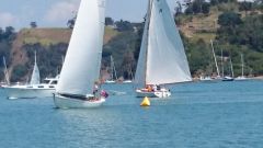
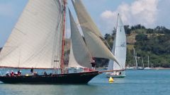
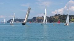
From the album: Mahurangi Regatta 2015
-
From the album: Mahurangi Regatta 2015
-
From the album: Mahurangi Regatta 2015
-
From the album: Mahurangi Regatta 2015
-
From the album: Mahurangi Regatta 2015
-
From the album: Mahurangi Regatta 2015
-
From the album: Mahurangi Regatta 2015
-
From the album: Mahurangi Regatta 2015
-
From the album: Mahurangi Regatta 2015
-
From the album: Mahurangi Regatta 2015
-
From the album: Mahurangi Regatta 2015
-
Warning points are part of the moderation process. Yes, some have been allocated.3 points and your out for a month etc. Given for breaches of the forum rules. It ain't a competition!
-
Done!
-
Can be a problem on smaller boats, or race boats. Easy to fix - here is a ruggedized PC (waterproof) for $225 2nd hand http://www.akl.trademe.co.nz/computers/laptops/laptops/other/auction-817687292.htm Toughbooks are often available on trademe...
-
Hi mark Mark, I have PM'd You with the "problems logging in" article from the front page. It is likely your account had the wrong email address. Do you want it fixed, or are you happy using this one? Site rules state you can only have one account.... Thanks Matt
-
Just remember that there is a little setup to do. Hit the spanner on the menu bar - look in plugins. Dashboard is the one that lets you add instruments for display - it will display almost anything that you have the data for. Many of the cool functions for OCPN are added with "plugins". There are lots. You can get most of them from here; http://opencpn.org/ocpn/downloadplugins They include the google earth plugin, GRIB files, Celestial navigation, Radar overlays, Polar diagrams, weather routing, logbooks and many many more. The Idea is that the base unit is small, fast, and clean. You can
-
TL, yes it runs fine on XP. Clipper; Turn on chart quilting; Go to Options -> Display ->General -> Enable Chart Quilting. Tick the box. Another, simpler way is to use the "Q" short key to toggle quilting on/off.
-
They dont see out well thru metal or carbon fibre. A proper, external GPS mushroom is under $200.00. How important to you is your primary nav source? Different of course if it is a backup as above...
-
Look on the open cpn web site for other chart formats. OCPN supports quite a few. If you think that the free nz charts are "a little rough" it is because they are raster charts - drawn with dots. vector charts - like your navionics- may look better, but are, in fact, often less accurate. The free NZ ones are as accurate as any charts currently available. To connect your existing gps units all you need is a suitable rs232 to usb adapter, available on trademe, or your local it supplier. NMEA 0183 output from the gps can go directly to the rs232 serial port.
-
Side decks Ash Whohoo!! They will look fine once varnished!
-
Cheapest not necessarily best! Do you have a GPS on the boat now? If so you can use the NMEA output from that. If you want cheap, you can share the GPS on your phone via bluetooth - free! Several apps available to do this. But IMO bluetooth is an unreliable solution. Cabled to a GPS with a good number of satellites and a decent refresh rate is best. The dongles work OK in area's with good coverage, not so good in some remote locations. An external GPS mushroom antenna works best.
-
Sorry about the pics guys. Most pics came thru the conversion properly, but some did not. These are some of these. Sorry, no way to recover them unless they are re-posted.