Island Time 1,313 Posted June 25, 2017 Author Share Posted June 25, 2017 Not always.... 1 Quote Link to post Share on other sites
Berend de Boer 2 Posted June 25, 2017 Share Posted June 25, 2017 Well one more, it seems the free NZ nautical charts + free OpenCPN gives you the right position. Why would anybody carry CM93? Old equipment on plotter? Quote Link to post Share on other sites
jonathan 4 Posted June 26, 2017 Share Posted June 26, 2017 Lots of boats have been lost at night thinking they where x miles away from an unlit reef. Lesson STAY WELL away from everything at night. There isn't a lot of hazards south of that reef, its almost a wing mark on the Minerva / Fiji sail. Quote Link to post Share on other sites
Black Panther 1,776 Posted June 26, 2017 Share Posted June 26, 2017 10 miles even better 1 Quote Link to post Share on other sites
ex TL systems 63 Posted June 26, 2017 Share Posted June 26, 2017 sailing from bundaberg to nz I put a ring of way points around middleton reef about 50 miles off , that is the only obstacle but plenty of boats have hit it and if you don,t zoom in on your charts they will show nothing often Quote Link to post Share on other sites
Myjane 40 Posted June 26, 2017 Share Posted June 26, 2017 I am missing something here , there was a back stay broken. Then there is a reef , so the back stay broke could the boat not carry on sailing , could it not be fixed ,jerry fixed folded in half ,lashed the New a rope , to the fitting , then a reef turns up did they drift onto the reef with no power , sail , no motor , if the back stay broke It would had at the ends , if it broke at the top , so turn out around , if it broke at the. Bottom fold it in half , lash it and tie it to the fitting as a temp fix , maby , Quote Link to post Share on other sites
Island Time 1,313 Posted June 26, 2017 Author Share Posted June 26, 2017 Cm93 is still used by a lot of cruisers. It's pirated, and free for the whole world. Free charts don't cover the world (yet). Quote Link to post Share on other sites
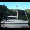
Myjane 40 Posted June 26, 2017 Share Posted June 26, 2017 I see a photo of the boat on the reef , a shame , Quote Link to post Share on other sites
jonathan 4 Posted June 26, 2017 Share Posted June 26, 2017 Only after they hit the reef, lost rig so lost most comms including stuff like sat phone in dodger, SSB ariel etc, they said king tide hid reef from radar, they where doing 10 knots when they hit, they must have had steerage. I don't like threading the needle in daylight let alone at night at that speed. If they only had paper charts at that point wouldn't you just sail well low of all danger like 15-20miles at night and only approach anything during the daylight? I have setoff windward in the pacific at midnight to avoid really heavy headwinds, and it gives me the Sh&ts everytime Quote Link to post Share on other sites
Myjane 40 Posted June 26, 2017 Share Posted June 26, 2017 Paper charts are fine if you know how to read them and decide to over electronics Quote Link to post Share on other sites
jonathan 4 Posted June 26, 2017 Share Posted June 26, 2017 At 10 knots you are only 20 mins away from a reef 3 miles away. At night 20 mins can go real quick if you have any problems and you also know you can;t climb, due to no solid backstay, you dont want anything in front of you full stop.... 30 tons of yacht with no backstay doing 10 knots just doesn't spell enough maneuverability to me at night, when you think you are 3miles away from an unlit reef. I am real glad they are ok, I just don;t think things leading up to it where prudent We have all heard stories of people who where sure in the pacific they where a few miles away.... If they had that speed they could have way pointed 20miles below that entire system when they where like 30miles away then headed north up towards fiji.... probably only adding an hour or twos sailing, more islands on that line further north but again WIDE berth due to inability to climb in an emergency... Or wait till daylight if you do need to thread needle Quote Link to post Share on other sites
Steve Pope 255 Posted June 27, 2017 Share Posted June 27, 2017 I think hitting the reef and the broken backstay are only linked in asmuch as after the stay broke, they appear to have decided to head for Fiji instead of on to Vavau /Hapai's etc. Hitting the reef is a navigation issue, Relying on radar to pick up a semi submerged reef in the dark? Hmm. well I wouldn't do it. the backstay breaking has to be a maintenance issue, or a failure of a fitting. That they were supposedly doing 10 knots would indicate they were sailing without worry, probably relying on running backstays etc. Quote Link to post Share on other sites
Jean 5 Posted June 27, 2017 Share Posted June 27, 2017 https://www.facebook.com/roger.foley.180/posts/1859954887577548 Radio NZ interview with one of the crew from Jungle. Wow a big expensive boat like that not insured. You would think an uninsured boat would be a bit more careful with their navigation. Although uninsured or not careful navigation around reefs is a must. In the interview only radar is mentioned re navigation I wonder what was happening with charts/electronic or others. Not sure if I am right but I thought Fiji require boat owners to dispose of any wrecks on reefs etc. Quote Link to post Share on other sites
Berend de Boer 2 Posted June 27, 2017 Share Posted June 27, 2017 Direct link to story: http://www.radionz.co.nz/national/programmes/checkpoint/audio/201848902/we-all-thought-we-were-going-to-die Quote Link to post Share on other sites
Berend de Boer 2 Posted June 28, 2017 Share Posted June 28, 2017 And here is the story where they left off: http://www.radionz.co.nz/national/programmes/checkpoint/audio/201848914/new-zealander-feared-for-his-life-in-fiji-yacht-crash Quote Link to post Share on other sites
Recommended Posts
Join the conversation
You can post now and register later. If you have an account, sign in now to post with your account.
Note: Your post will require moderator approval before it will be visible.