Deep Purple 512 Posted April 20, 2018 Share Posted April 20, 2018 The Mokes is indeed a long way off course from Whangaparaoa to Great Barrier. Not Horne Rock either, I took a picture of it the other day. I wonder where it actually was But then the media doesn't care too much for accuracy these days in the rush to get a headline. Read this gem Quote Link to post Share on other sites
ScottiE 174 Posted April 20, 2018 Share Posted April 20, 2018 perhaps they outsourced that story offshore as a cost cutting execrise Quote Link to post Share on other sites
erice 732 Posted April 20, 2018 Share Posted April 20, 2018 presumably the mokes in the background/ https://www.google.co.nz/maps/@-36.0255327,174.8794536,10z?hl=en-GB Quote Link to post Share on other sites
John B 106 Posted April 20, 2018 Share Posted April 20, 2018 I've seen Horn rock in a big swell sailing past , great fishing there if you can get past the sharks. But the really interesting thing about it and Puff's photo shows that off well, is how extensive the shallows are around it. I sat there on a calm day fishing but the lift over the whole area was quite something to see relative to just being off a hundred metres. Quote Link to post Share on other sites
ScottiE 174 Posted April 20, 2018 Share Posted April 20, 2018 makes you wonder if its a case of having the chartplotter zoomed out too far Quote Link to post Share on other sites
John B 106 Posted April 20, 2018 Share Posted April 20, 2018 That's why I wondered about Simpson rock. Quote Link to post Share on other sites
harrytom 646 Posted April 20, 2018 Share Posted April 20, 2018 classic reporting by media "puff" have not used the old bridge for how many years now? nice shot of horn rock,never seen it or been close,I believe it use to be prominent till the navy used it as target practice. Quote Link to post Share on other sites
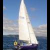
Crazyhorse 47 Posted April 20, 2018 Share Posted April 20, 2018 Was she 'Calusa'? Quote Link to post Share on other sites
Battgirl 23 Posted April 21, 2018 Share Posted April 21, 2018 Northern Advocate reported the cat is called Questing Quote Link to post Share on other sites
Crazyhorse 47 Posted April 21, 2018 Share Posted April 21, 2018 Northern Advocate reported the cat is called Questing Thanks. Quote Link to post Share on other sites
waikiore 399 Posted April 23, 2018 Share Posted April 23, 2018 Looks as if they were lost and motoring, and thought they were nearing the Barrier Quote Link to post Share on other sites
John B 106 Posted April 23, 2018 Share Posted April 23, 2018 O dear. Quote Link to post Share on other sites
Fish 0 Posted April 23, 2018 Share Posted April 23, 2018 Looks as if they were lost and motoring, and thought they were nearing the Barrier Is that speculation on your part, or is that based on some information? Quote Link to post Share on other sites
Mrs Rafferty Rules 5 Posted April 24, 2018 Share Posted April 24, 2018 Don't believe anything the media says what they have reported is not correct. They knew were they were, we have all made some sort of mistake boating!!! Credit to the skipper for getting everyone safely ashore. 1 Quote Link to post Share on other sites
IanG 0 Posted April 25, 2018 Share Posted April 25, 2018 The Harbourmaster has issued a Local Notice to Mariners detailing the location of the sunken catamaran at the Mokohinaus. Go to https://at.govt.nz/about-us/harbourmaster/local-notices-to-mariners/ for the details. Quote Link to post Share on other sites
Fish 0 Posted April 25, 2018 Share Posted April 25, 2018 Would that be a prospective anchorage in settled weather, just adjacent to where the wreck is reported, SW side of Atihau Island? 5 m depth on a sandy bottom, clear of obstructions, fringed by islands, rocks and reefs from all directions accept the North West? Looks like a nice spot on aerial photos, only question is the extent the swell is broken by the rocks and reef. Probably up there on a prospective list given the state of every other likely anchorage at the Mokes. Quote Link to post Share on other sites
khayyam 71 Posted April 25, 2018 Share Posted April 25, 2018 that whole area is marked foul ground in the RAYC handbook Quote Link to post Share on other sites
Fish 0 Posted April 25, 2018 Share Posted April 25, 2018 The RAYC handbook shows a rudimentary hand sketch. Jim Cook may have used those... Memory Map shows it clear on fine sand when entering from the North West (to the north of the foul ground) Navionics concurs with Memory Maps, including Navionics sonar chart (i.e. private sonar logs that tend to show much greater detail, especially features that fisho's may like, these have a habit of showing up lumpy bits that mar be a problem for yachts). Finally, aerial photos concurs with both Memory Maps and Navionics. David Thatcher's Hauraki Guide states "There are no truly sheltered anchorages at the Mokes, but there are still several bays where anchoring is possible subject to weather conditions. So back to the question, given settled weather, who would consider anchoring on the SW side of Atihau Island, north of the foul ground shown on the charts? 5 m on a sandy bottom. Who has been there and can comment on the effectiveness of the islands, islets, rocks and foul ground at stopping the swell, and what about tidal stream? Quote Link to post Share on other sites
darkside 61 Posted April 25, 2018 Share Posted April 25, 2018 The main anchorage is the north side of Atihau (or Trig) Is next to the Arch Rk. I've had a few calm nights in there but you would be pretty brave to anchor as far in as the RAYC suggests. In anything with N in it the south side of Burgess is OK but persistent swell is a problem. I have tucked into Maori Bay on the north side of Flax once and was pretty pleased with myself till the tide turned. Then we had to sit and roll until we could see well enough for it to be safe to leave. 1 Quote Link to post Share on other sites
Chewing Gum 17 Posted April 26, 2018 Share Posted April 26, 2018 Stayed there a couple of times but weather has to be really settled, south side Burgess and also Nth of Atihau and I think maybe also west side Burgess. Walk up to light house from wharf pretty cool. Ray Walters the last light keeper built a 28ft launch up by the light from Kauri ex one of the houses intending to send it down the railway (very steep) but in the end an Iroquois lifted it off ! As someone mentioned watch out for Simpson rock on your way there. Quote Link to post Share on other sites

Recommended Posts
Join the conversation
You can post now and register later. If you have an account, sign in now to post with your account.
Note: Your post will require moderator approval before it will be visible.